Smarter Farming
Map - Analyse - Optimise

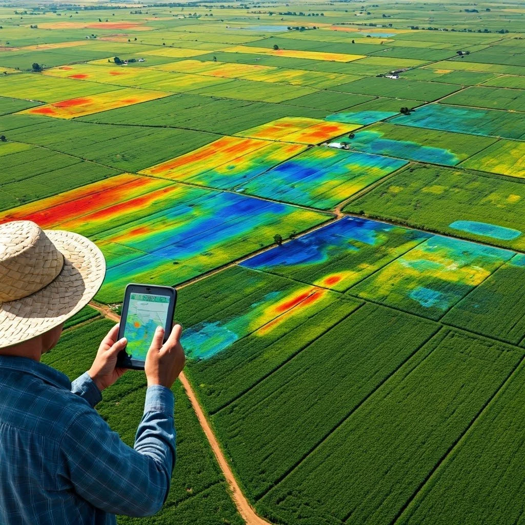
Aerial Intelligence.
Focus where it matters most.
Identify issues quickly.
Maximise input efficiencies. Optimise every hectare.
No Guesswork.
Just Results.
Our company
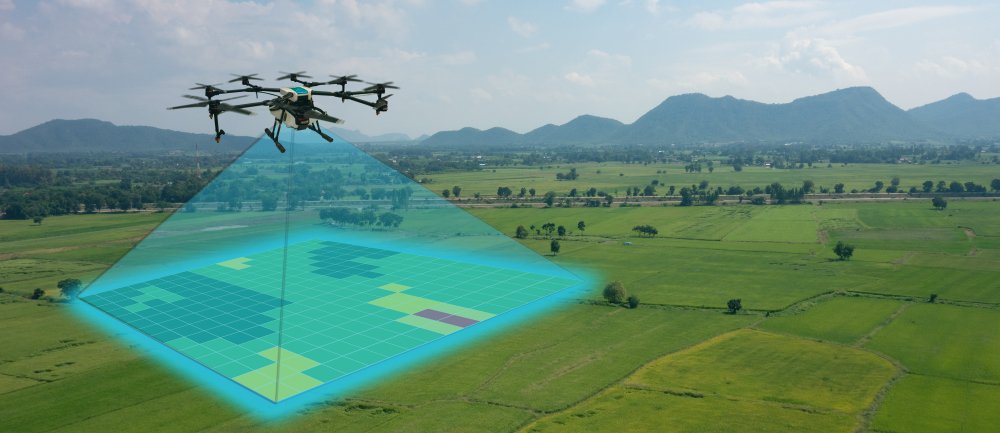
FieldView operates at the forefront of agricultural innovation, utilising spectral analysis and remote sensing to deliver data-driven digital analytic tools that enhance decision-making across the agriculture value chain.
Our platform empowers growers, agronomists, and enterprise partners to act with greater precision, efficiency, and sustainability. Driven by science, backed by global expertise, and committment to our customers, FieldView is a trusted partner in aerial analytics.
Wherever agriculture thrives, FieldView is there supporting the optimisation of yields, input usage, and environmental performance across the world’s most critical agricultural systems.